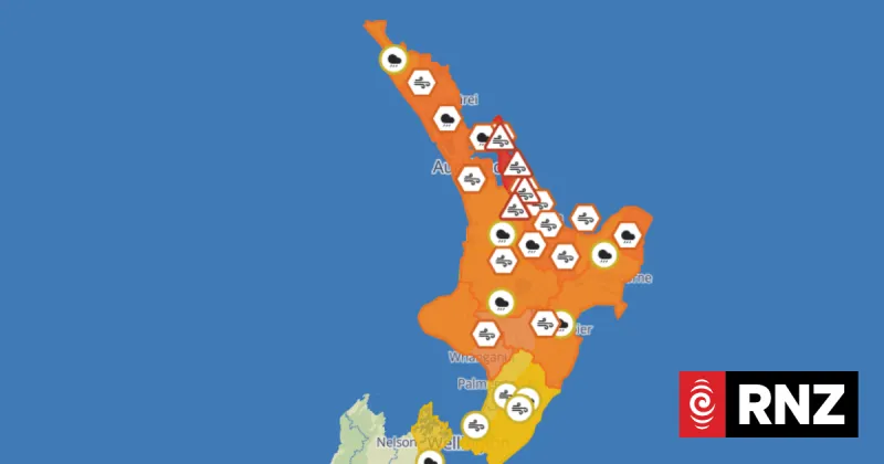
Severe weather warnings are in effect for much of New Zealand's North Island as Cyclone Vaianu approaches from the northeast. MetService has issued red heavy rain warnings for the Coromandel Peninsula, Bay of Plenty, and Gisborne/Tairawhiti regions, with significant flooding and slips expected.
The forecaster states the cyclone is likely to track close to or over the Coromandel Peninsula and Bay of Plenty on Friday and Saturday, before moving over the rest of the island. Rainfall accumulations could exceed 250mm in some areas, accompanied by severe easterly gales.
Authorities are urging residents in affected regions to prepare for disruptions, including potential road closures and power outages. Emergency Management officials advise people to secure loose items, check on neighbors, and have emergency supplies ready.
The severe weather is expected to ease from the north on Sunday as the system moves away. Travelers are warned to check conditions before setting out, with significant impacts likely on road and air transport.